| Topography | ||
|
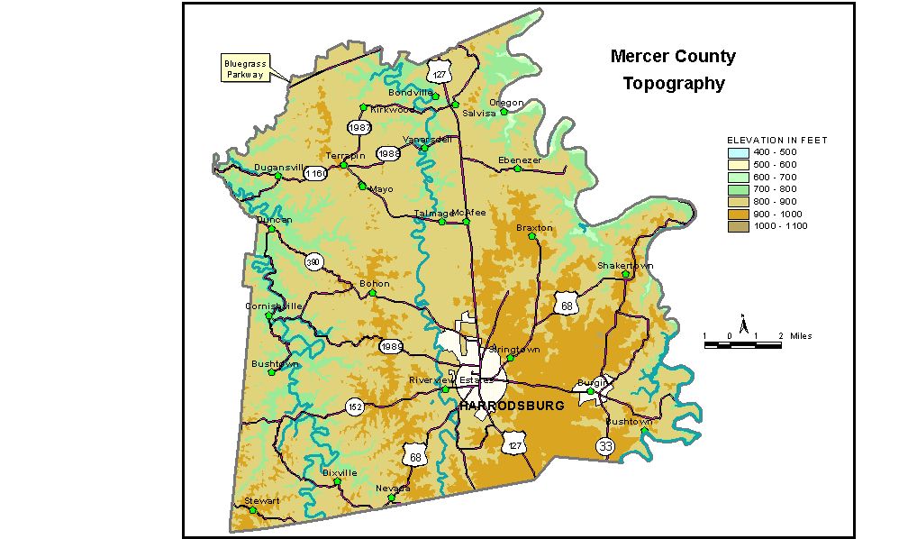
Discussion from McGrain and Currens (1978) Mercer
County is in the Bluegrass Region of central Kentucky. The topography
is gently rolling to hilly, with the steepest slopes and greatest local
relief being in the eastern edge of the county near the deeply incised
valleys of the Dix and Kentucky Rivers. The area of lowest local relief is in the vicinity of Harrodsburg.
Ridgetop elevations are between 900 and 950 feet. Locally, fairly large
areas of nearly flat land are present at these elevations. Some sinkhole
topography is present on this upland surface, but it does not dominate
the landscape. The highest point in Mercer County, 1,000 feet, is on
a ridge just south of Kentucky 152 about 2.5 miles east of the center
of Harrodsburg. The area west of Salt River is hilly. Little flat land is present, except along the valleys of the Chaplin and Salt Rivers. Ridgetop elevations generally range between 850 and 900 feet, and the local relief is commonly 100 to 150 feet. The elevation of Harrodsburg, the county seat, in the center of the city, is 850 feet. Other elevations are Bohon, 897 feet; Bondsville, 779 feet; Burgin, 893 feet; Cornishville, 733 feet; Mayo, 900 feet; Nevada, 821 feet; Oregon, 523 feet; Salvisa, 785 feet; and Shakertown, 930 feet. The Southern Railroad bridge (High Bridge) over the Kentucky River near Shaker Village at Pleasant Hill is at an elevation of 795 feet, 281 feet above the river. The 7.5-minute topographic quadrangle maps that cover Mercer County
are shown, by name and by index code (Kentucky Natural Resources and
Environmental Protection Cabinet) on the index
map. Previous--Next--Back to "Groundwater Resources in Kentucky"
|
||