| Topography | ||
|
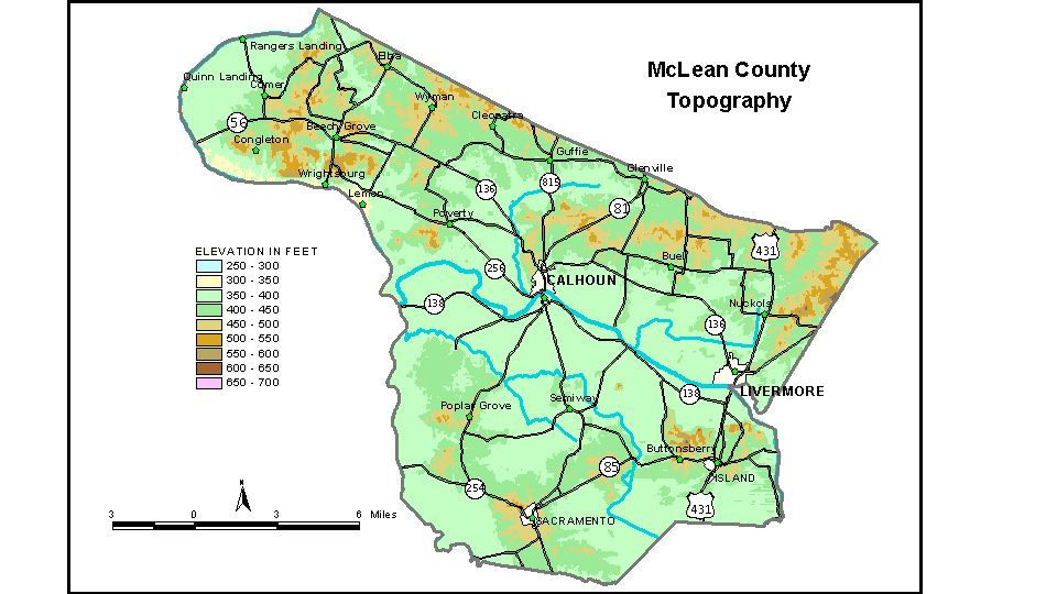
Discussion from McGrain and Currens (1978) McLean
County is located in the Western Kentucky coal field. The topography
is characterized by patches of low hills separated by broad valley flats,
the wide bottom lands along Green River and its tributaries are the
most striking feature of the terrain. The lowest elevations in the county
are found here. Elevations along the flood plain are between 380 and
400 feet. The lowest point, approximately 545 feet, is Green River where
it leaves the county. The elevation of Calhoun, the county seat, is 395 feet. Other elevations are Beech Grove, 398 feet; Glenville, 441 feet; Island, 430 feet; Livermore, 408 feet; Rumsey, 387 feet; and Sacramento, 497 feet. The 7.5-minute topographic quadrangle maps that cover the county are
shown, by name and by index code (Kentucky Natural Resources and Environmental
Protection Cabinet) on the index
map. Previous--Next--Back to "Groundwater Resources in Kentucky"
|
||