| Topography | ||
|
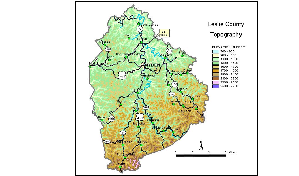
Discussion from McGrain and Currens (1978) Leslie
County is in the mountainous Eastern Kentucky coal field. Ridgetop
elevations generally range from 1,400 to 1,600 feet in the north and
from 2,000 to 2,200 feet in the south. The highest elevations in the
county, in excess of 2,400 feet, are recorded on the Leslie-Harlan County
line at the southern edge of the county. The highest point is Peters
Knob with an elevation of 2,600 feet. Peters Knob is on that portion
of the Leslie-Harlan County line which is also the divide between the
drainage basins of the Kentucky and Cumberland Rivers. The elevation of Hyden, the county seat, is 870 feet. Other elevations are Cutshin, 1,020 feet; Napier, 1,156 feet; and Wooten, 873 feet. The 7.5-minute topographic quadrangle maps that cover the county are
shown, by name and by index code (Kentucky Natural Resources and Environmental
Protection Cabinet) on the index
map. Previous--Next--Back to "Groundwater Resources in Kentucky"
|
||