| Topography | ||
|
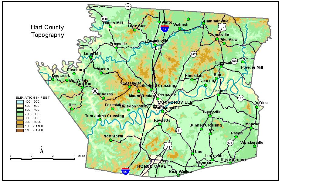
Discussion from McGrain and Currens (1978) Hart
County lies largely in the Mississippian Plateaus area of south-central
Kentucky. Topographically, it occupies two plateau areas. The lower
area is a slightly rolling limestone plain characterized by few surface
streams and thousands of sinkholes. Elevations on the sinkhole plain
range from about 750 feet on the east to 640 feet on the west, at the
base of the Dripping Springs escarpment. The sinkhole plain is studded
with irregular hills and ridges, erosion remnants from a retreating
escarpment, which rise 100 feet or more. Green River follows a sinuous route across the center of the county.
It is entrenched 150 to 200 feet below the karst plateau. The area north
of the river is hilly and contains the highest elevations in Hart County.
Several hills attain elevations in excess of 1000 feet. The highest,
Frenchman Knob about 6 miles north-northeast of Munfordville, is 1156
feet at the triangulation station. Three high knobs, 6 to 8 miles northeast
of Munfordville, are Three Kiln Knob at 1080 feet, Grindstone Knob at
1078 feet, and Knox Knob at 1040 feet. Maxey Knob, south of Green River
near the Hart-Green County line, is 1082 feet. The lowest elevation in the county, 421 feet, is the normal pool level
of Green River where it leaves the western edge of the county. The elevation of Munfordville, at the courthouse, is 612 feet. Elevations of other communities are Bonnieville, 670 feet; Canmer, 645 feet; Cub Run, 766 feet; Hardyville, 704 feet; Hammonville, 710 feet; Horse Cave, 635 feet; and Rowletts, 663 feet. The normal pool elevation of Nolin Lake is 515 feet. The 7.5-minute topographic quadrangle maps that cover the county are
shown, by name and by index code (Kentucky Natural Resources and Environmental
Protection Cabinet) on the index
map. Previous--Next--Back to "Groundwater Resources in Kentucky"
|
||