
MouseOver to see fault zone

MouseOver to see fault line.

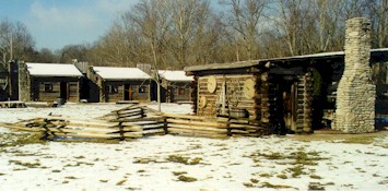
 (see photo on right of interior of the reconstructed fort) was the second oldest continuous settlement in Kentucky. The fort was located on the floodplain of the Kentucky River, just 1/4 mile above the point where the river crosses the Kentucky River Fault System and where the river valley and floodplain narrow to enter the Kentucky Palisades. The floodplain deposits are mapped as alluvium on the new Harrodsburg map. During Boone's time, a natural ford across the river was located here as well. This location would have provided continuous water, transportation, and flat, arable land. The fort was situated within the Inner Bluegrass region, known for its limestone bedrock with a high phosphate content (in the form of calcium phosphate). This natural occurrence of phosphate is one of the reasons that this area is desirable for farmland; phosphate is one of the important soil nutrients for crops as well as livestock. As for salt, presumably salt brine was available at two brackish springs near the Fort (Town Lot Spring and another). However, the salt content was not very high and they were both sulfury). Most of the early settlers at Fort Boonesborough spent considerable time travelling to and from Blue Licks in northern Kentucky for the purpose of making salt from salt springs.

|
Fort Boonesborough floodplain across the Kentucky River. The original fort was constructed just to the right of the building in the center of the photograph. Note the lack of Palisades behind the floodplain. Note also the first part of the Palisades at the extreme right in the photograph (behind Memorial Bridge). Ford 7.5-minute quadrangle. 25 KB image, 142 KB image. |
 MouseOver to see fault zone |
Boonesboro Quarry (The Allen Company), from Memorial Bridge, looking downstream. Uppermost quarry face is composed of Oregon Formation, quarry is in the Camp Nelson Limestone. The Kentucky River Fault is in the valley to the left of the quarry face and extends to the lower right below the river level. Ford 7.5-minute quadrangle. 23 KB image, 128 KB image. |
 MouseOver to see fault line. |
Intersection on east bank of Kentucky River at Memorial Bridge. Kentucky River Fault, Camp Nelson Limestone on left (upthrown side), Lexington Limestone on right (downthrown side). Ford 7.5-minute quadrangle. 39 KB image, 181 KB image. |

|
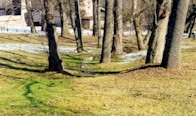
Water seep from the now-covered Town Lot Spring, Fort Boonesborough State Park. Ford 7.5-minute quadrangle. 43 KB image, 256 KB image. |
See Fort Boonesborough State Park (Kentucky Parks website) for more historical information about this fort.