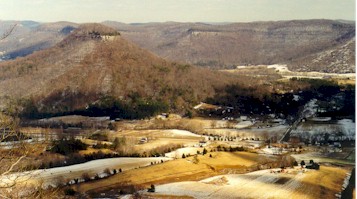

Along the southern part of the area covered by the map are isolated knobs (called monadnocks or erosional remnants in geologic terms). The knobs can be seen as isolated 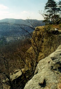 color patterns on the southern part of the map. These knobs make up part of the Knobs geologic region, an arcuate belt around the Bluegrass Region. In the southeastern part of the map, an elevated plateau is found. This is part of the Eastern Kentucky Coal Field (also known as the Cumberland Plateau). An escarpment known as the Cumberland Escarpment marks the edge of the plateau. In the geologic past, the plateau extended beyond the knobs. As erosion progressed, the plateau and escarpment retreated to the southeast, leaving the knobs as erosional remnants of the original plateau. Several parks and hiking trails take advantage of the scenic vistas along the knobs and escarpments of this region (e.g., Indian Fort Trail and park, Pilot Knob, Bighill, in the photograph above).
The Cumberland Plateau and Knobs are uplands because they are capped by a layer of resistant strata. In the southeastern part of the mapped area, the resistant layers are the Livingston Conglomerate at Indian Fort Mountain (see photograph at right), Slade Limestone at Big Hill, and the silstones of the Borden Formation at Halls Gap (Stanford) and Junction City in the south-central part of the map.
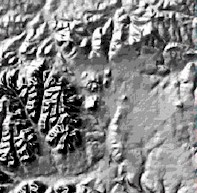 MouseOver to see geology | Shaded relief map of Junction City area, Junction City 7.5-minute Quadrangle. 35 KB shaded relief image, 122 KB geology map image. |

|
Cumberland Escarpment at Junction City from Ky 300, about 3 miles east of Junction City, looking west. Members of the Borden Formation are the resistant strata capping this part of the plateau. Junction City 7.5-minute quadrangle. 20 KB image, 115 KB image. |
|
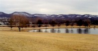
Cumberland Escarpment near Stanford. View from US 27 north of Halls Gap, looking southwest. The resistant strata capping the escarpment here are members of the Borden Formation. Halls Gap 7.5-minute quadrangle. 21 KB image, 128 KB image. |
|
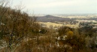
View of Stanford from overlook on the Cumberland Escarpment at Halls Gap. Note the relatively flat land of the Bluegrass Region in the background and the small knob in the center of the photograph. Halls Gap 7.5-minute quadrangle. 9 KB image, 154 KB image. |
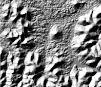 MouseOver to see labels | Shaded relief map of the Indian Fort Mountain, Pilot Knobe and Bighill area, Bighill 7.5-minute quadrangle. 39 KB shaded relief image. |
|
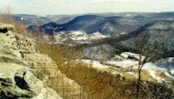
View from East Pinnacle of Indian Fort Mountain looking southeast at Bighill Mountain (center background) and Millstone Ridge (to right). This is the Cumberland Escarpment. Note the flat top of the Cumberland Plateau along the horizon. Also note the quartz-pebble-bearing sandstone in the foreground, part of East Pinnacle. This sandstone is part of the Livingston Conglomerate. Bighill 7.5-minute Quadrangle. 35 KB image, 204 KB image. |
|
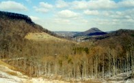
View of Pilot Knob from Bighill area, from US 421 looking north. Pilot Knob is just right of center in the background. Millstone Ridge is on the left. The Slade Formation is exposed at ridge top (on left) and part of the Borden Formation is exposed in the roadcut. Bighill 7.5-minute Quadrangle. 28 KB image, 145 KB image. |
|
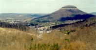
Closeup view of Pilot Knob looking north from US 421 on Bighill Mountain. Note the relatively flat Lexington Peneplain part of the Bluegrass Region in the distant background. Bighill 7.5-minute Quadrangle. 23 KB image, 150 KB image. |

|
Roadcut at top of Bighill Mountain on US 421 near Morrill, looking north. The Paragon Formation is in the grass-covered slope between the trees and the top limestone exposure. The limestone exposed on the right roadcut is the Poppin Rock (Bangor) Limestone Member of the Slade Limestone. The more distant roadcut on the left exposes underlying members of the Slade Limestone. Bighill 7.5-minute Quadrangle. 24 KB image, 145 KB image. |