
MouseOver to see fault
Click to see larger image

MouseOver to see fault
Click to see larger image

MouseOver to see fault
Click to see larger image

MouseOver to see fault
Click to see larger image


The varied geologic features visible in the Camp Nelson area, its historical significance and its scenery are reasons why this area has been submitted as a candidate for the Kentucky Society of Professional Geologists' Distinguished Geologic Site.

|
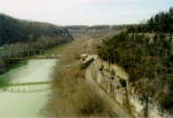
Kentucky River Palisades from the US 27 bridge at Camp Nelson (looking downstream). Strata exposed on the right is Camp Nelson Limestone. This area is the type locality for the Camp Nelson Limestone and the thickest outcrop of this unit in the state. Little Hickman 7.5-minute Quadrangle. 28 KB image, 159 KB image. |
 MouseOver to see fault Click to see larger image |
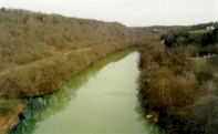
Kentucky River from the US 27 bridge at Camp Nelson (looking upstream). The northwestern boundary fault of the Lexington Fault System crosses the river at the confluence with Hickman Creek (lower left of photograph). Little Hickman 7.5-minute Quadrangle. 22 KB image, 138 KB image. |
 MouseOver to see fault Click to see larger image |
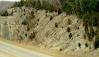
Folded and faulted strata associated with the northwestern boundary fault of the Lexington Fault System. Outcrop is just south of the US 27 bridge at Camp Nelson, eastern side of road. Little Hickman 7.5-minute Quadrangle. 17 KB image, 136 KB image. |
 MouseOver to see fault Click to see larger image |
Close up photograph of folded strata associated with the fault at the above locality. Little Hickman 7.5-minute Quadrangle. 27 KB image, 192 KB image. |
 MouseOver to see fault Click to see larger image |
Folded and faulted strata associated with the fault at the above locality, western side of road. Little Hickman 7.5-minute Quadrangle. 52 KB image, 86 KB image. |

|
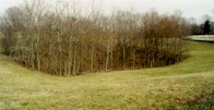
Sinkhole seen from the eastern side of the Camp Nelson National Cemetery. Little Hickman 7.5-minute Quadrangle. 26 KB image, 162 KB image. |

|
Large sinkhole seen from the northern side of the Camp Nelson National Cemetery. All of foreground is sloping toward the sinkhole. Little Hickman 7.5-minute Quadrangle. 28 KB image, 175 KB image. |
References:
Gilreath, J.S., Potter, P.E., and Losonsky, G., 1989, Guide to interpretation of structural features associated with the Kentucky River Fault System along U.S. Highway 27 near Camp Nelson, Kentucky. KGS Map and Chart Series 1, Series XI.
Greb, S.F., Dever, G.R., Jr., and Anderson, W.H., 1997, Economic geology of the Inner Blue Grass Region. Kentucky Society of Professional Geologist Annual Field Trip Guidebook, 47 p.
Off site links related to Camp Nelson