KGS Home > Oil and Gas
FAQ: Do I have oil (or gas) on my property?

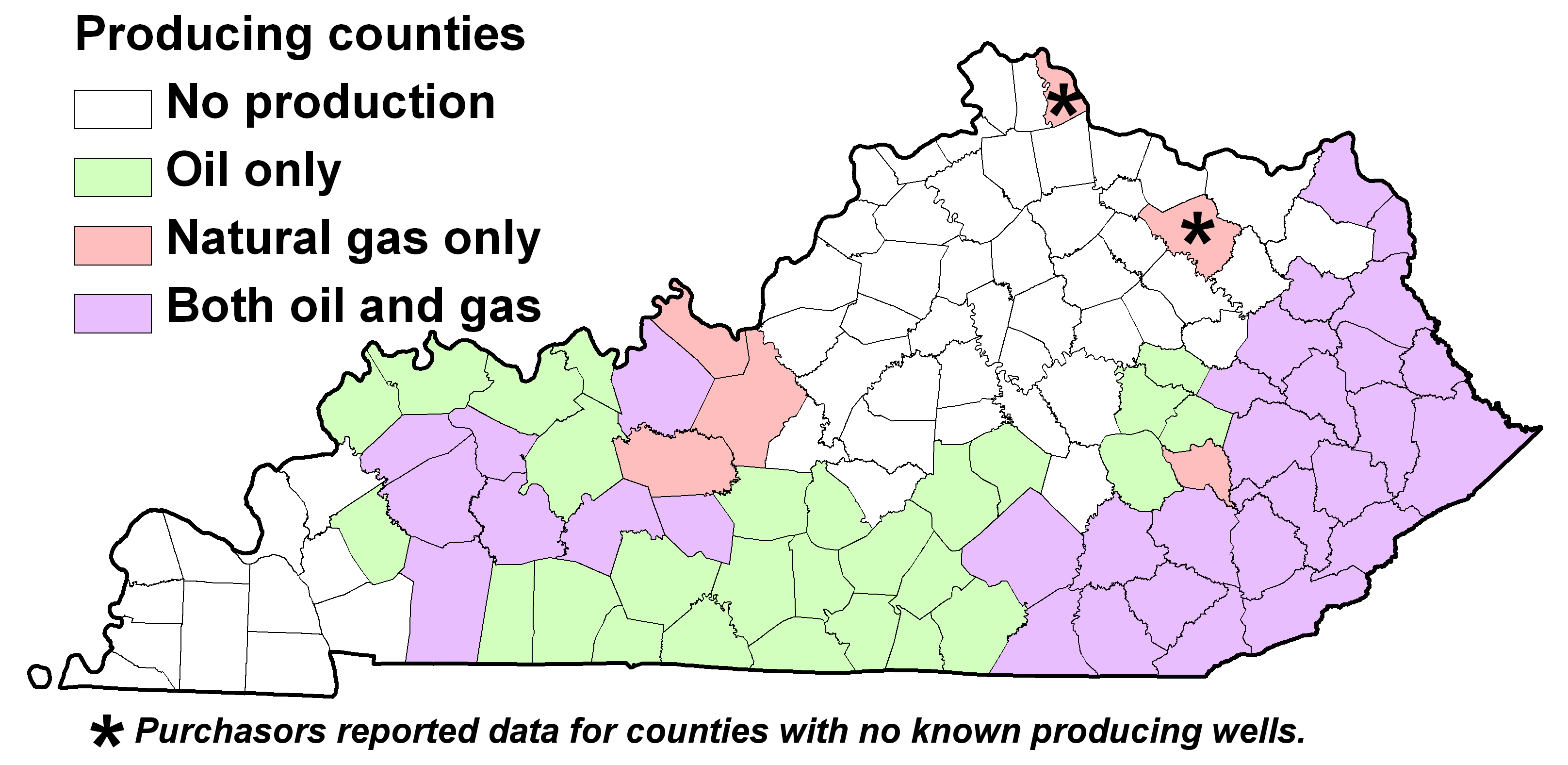
Counties with reported oil and gas production for 2006
(latest year for which production data are publicly available).
|
This question is related to several others:
- I inherited property and it has some old wells on it. What can I find out about the wells?
- Can I get a map of the gas wells near my property?
- Who is drilling wells near my property?
The only way to be certain is to drill a well. Even if hydrocarbons are present, whether or not recovering that oil or gas can be profitable is dependent on many factors. If you live in an area of known oil or gas production and have producing wells on surrounding tracts of land, the probability of having oil or gas increases. However, even with nearby producing wells, there is always an element of risk in exploration and development of petroleum resources.
Charts oil or gas production data by county, region, or statewide are available, see the oil and gas production page.
Searching for wells using areas and search limits.
- Go to the Search the Oil and Gas Records page.
- Set the search method to search by county and select your county. There are other ways to search for wells near your location.
- You can specify various limits on which wells are returned by the search. If you get many wells, try limiting the search to more recent wells (Limit by Date or Limit by Included Data, completion data or production data are suggested).
- Click the Search for Oil and Gas Wells button. A table of the wells returned by your search will be displayed. If you installed DjVu, you can click on the View Records link to see scanned images, or click on the geologic map service link to see the well on a map.
Searching for wells using an interactive map.
- Go to the KGS Geologic Map Service
- Use the zoom and pan tools in the toolbar to find the area in which you are interested, or
- Use the zoom to location tool to find areas by county, topographic map, streams, roads, and others.
- After having found your area of interest, click the Petroleum Geology Map layout in the layer list to switch to an oil and gas map. You can also control what is displayed on the map using the choices in the customize map menu.
- To display a key to the symbols and data themes displayed, click the Map Legend link (on the right at the top of the map contents and layouts list).
- To find information about a particular well, click the identify tool on the left (black dot with lower case letter "i") then click on features in the map area. You can select multiple features with the select area tool (smaller black dot with letter "i" in the lower right of a dashed box). Click the icon to make it the active tool, then click and drag in the map area to select features.
- Use the print icon (printer at bottom of tool bar on left) or the save the map as a georeferenced image (icon with red arrow pointing down to a disk drive).
Note that the map and tabular searches are linked to each other. From the map, you can get to the table and display the scanned well record images and from the table, you can display a map showing the well location.
Links:
© 2002
Kentucky Geological Survey,
University of Kentucky
Created 18-Jul-2002


