
KGS Home > News and Announcements
New Western Kentucky Geologic Map Released by KGS
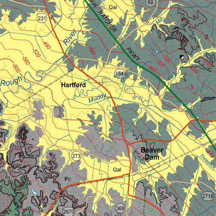
Lexington, KY. (December 20, 2007) - A newly-published geologic map of parts of western Kentucky includes useful information for community planners, energy-related industries and others interested in the geologic resources of this region.
The 30 x 60 minute quadrangle (compiled at a 1:100,000 scale) and the digital data used to create it are both published by the Kentucky Geological Survey (KGS) at the University of Kentucky. They are the result of detailed assembly of digitized 7.5-minute geologic quadrangle maps of the area, known as Digitally Vectorized Geologic Quadrangle (DVGQ) maps.
Entitled Geologic map of the Beaver Dam 30 x 60 Minute Quadrangle, Western Kentucky, it is compiled and authored by geologists Mark F. Thompson, Stephen T. Plauché and Matthew M. Crawford. It is the 13th of a series of such maps developed and published by KGS.
Kentucky is geologically mapped at a scale of 1:24,000, by a total of 707 of the 7.5-minute geologic quadrangle maps. KGS has converted the original paper versions of these large scale maps to digital vector format. Thirty-two of the digital versions of the DVGQ maps were compiled to create the new map at a 1:100,000 scale. The newly compiled map retains the accuracy and detail of the original ones it was created from and allows a regional perspective on the geologic setting at the new scale.
The map includes all of two Kentucky counties (Butler and Edmonson) and portions of several surrounding counties. The cities of Beaver Dam, Brownsville, Caneyville, Hartford, Morgantown, Leitchfield and Park City are on the map as well as the northern portion of Bowling Green.
The mapped area is within the Western Kentucky Coal Field at the southern edge of the Illinois Basin. In addition to significant coal reserves, it has a history of production from oil, gas, rock asphalt “tar sands” and limestone deposits. The western portion of the mapped area includes the Rough Creek Graben, a deep Cambrian rift basin which KGS and private partners are evaluating for its oil and gas potential and its feasibility for carbon dioxide (CO2) sequestration.
Community planners will find plenty of valuable information on the map on topics from water resources to geologic hazards. For instance, the text portion of the map notes that engineering evaluations should be conducted when development occurs in the Bowling Green area, due to caves and karst terrain prevalent in that area. Mammoth Cave National Park is highlighted both on the geologic map and within the discussion.
The digital vector files used to create this map are available from KGS on CD-ROM for $10 per individual DVGQ and can be used in geographic information systems (GIS) and other computer software. The digital data sets allow GIS users to combine the geologic map data with other data for multiple purposes, including geologic hazard mitigation and assessment of energy and mineral resources. The digital data sets can also be used to create custom maps; they are ideal for land-use development and planning.
To view this publication on-line, go to the KGS Publications & Map catalog at http://kgs.uky.edu/kgsweb/findpubsmain.asp. Enter this publication’s number, 17177, in the box next to “Enter Publication Number or SkuCode”, and to the right of this box select "exact publication id" from the pull down menu. Clicking on the “Search” button opens a new page with a link to the map.
Paper copies of the map are available from the KGS Public Information Center on the UK campus for $10 each plus shipping and may be ordered by calling (859) 257-3896 or toll free at (877) 778-7827.
