
KGS Home
Kentucky Teachers Using Geological Survey Maps in Classrooms
Lexington, KY. (April 22, 2008) – Hundreds of teachers across the state have responded enthusiastically to the offer of free county geology maps from the Kentucky Geological Survey (KGS) at the University of Kentucky. Nearly 400 of these maps have been sent to classrooms in 90 Kentucky counties since November, 2007 through a “Maps-to-Teachers” service.
The map series, Generalized Geologic Maps for Land-Use Planning, was developed to help non-geologists understand the geology of the place where they live, work, and play. Maps have been completed for each of Kentucky’s 120 counties. “The maps are based on the detailed geologic field mapping that Kentucky carried out in the 1960’s and ’70’s,” says map series developer Dan Carey of KGS. “The original maps were digitized by KGS staff, and 20 geologists from KGS, state agencies, federal agencies, and the private sector volunteered their time and expertise to create the new county maps.”
“When we first started making the maps,” Carey adds, “the idea was to help people avoid the damages of common geologic hazards, which rarely make the news but add up to millions of dollars each year across the state. As we continued to develop the maps, we expanded their message to also help students and the public better understand how the rocks beneath their feet shape the land and the ways that they live on it.”

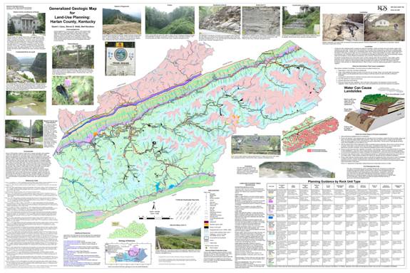
The Harlan County edition of the Generalized Geologic Map for Land-Use Planning.
Each of the large, colorful maps shows the major rock units found in the county, along with other important features such as wells, springs, wetlands, landslide deposits, mined areas, sinkholes and other features that should be considered when planning the construction of buildings and infrastructure. The maps are not intended to be the sole basis for local land-use plans or site-specific developments, but they can be very useful for showing local planners, builders and homeowners the pitfalls to be avoided when building in a particular area.
Teachers at the 2007 conference of the Kentucky Science Teachers Association were offered a free classroom copy of their county’s map at the KGS display booth. The response was overwhelmingly positive, and inspired the subsequent Maps-to-Teachers service that offers free, laminated county maps for classrooms and libraries in all Kentucky schools.
“Maps seem to attract people of all ages—from my 3-year-old grandson to senior citizens—who want to see and learn more about the place where they live,” says Carey. “Providing these maps to classrooms across the state seemed to be a great way to realize both KGS’s and UK’s mission of service and dedication to applying, sharing, and disseminating knowledge across Kentucky, as we work to make the Commonwealth a better place to live and learn.”
Just a few of the comments from map recipients:
Teachers who have not yet received a county map for their classroom are encouraged to either go to the web link http://www.uky.edu/KGS/announce/landuse_teacher.htm
or contact Dan Carey at carey@uky.edu.